

LOCATION The Kalash valleys of Chitral are located in the southern gorges of the Hindu Kush mountain range in Pakistan’s Khyber Pakhtunkhwa Province. The valleys share a 380 km border with Afghanistan in the north & west, and the Central Asian states of Tajikistan, Uzbekistan and Kirghizstan are easily accessible from the area. To the east lies Gilgit, from where one can reach China’s Xinjiang Autonomous Region along the legendary Karakoram Highway.

ORIGION OF KALASH
There are three theories about the origin of the Kalash. Some historians believe that the Kalash are descendants of the soldiers of Alexander the Great, while the second group believes that they are indigenous to Asia and came from what is now the Nuristan area of Afghanistan, and according to the third school of thought; the Kalash ancestors migrated to Afghanistan from a distant place in South Asia, which they call “Tsiyam” in their folk songs and epics. However, it is established that the Kalash migrated to Chitral from Afghanistan in the 2nd century B.C.
Kalash Architecture
Kalash architecture is a unique mixture of ancient wooden craft and medieval traditions of figure art. Multi-storied Kalash buildings present a spectacular view of beautifully carved wooden pillars and beams decorated with unmatchable human and animal figures and effigies. Each one depicts certain myths and superstitions.
Kalash Culture Centre
The Kalash Culture Centre is in Brun, Bumburet valley, where folk history, culture and civilisation of the Kalash is preserved under one roof. It is an ethnological museum of the Kalash community, initiated and facilitated by the citizens of Greece. Nearby is a government-run archaeological museum.
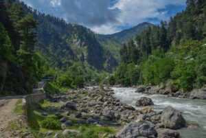
FAMOUS LAKES IN KALASH VALLEY
Bahuk the Sacred Lake
Bahuk, the sacred lake of the Kalash ancestors, lies between the two picturesque valleys of Bumburet and Rumbur. The turquoise-hued glacier lake is situated at 4000m amongst an amphitheatre of jagged peaks with a good view of Tirich Mir 7708m to the west. The Kalash believe that after the death, their souls go to this Lake. The area is famous amongst both the Kalash and the Muslim Kho community as the resting place of fairies. Reported sightings of a mythical Barmanu (yeti) have also been made here. Its surroundings are the summer pastures of the Kalash community and villagers from Ayun. It has some magnificent cedars, some 1,200 years old. There are lovely treks from both Bumburet and Rumbur linking different valleys in the region where you can see shepherd settlements and a variety of fauna and flora. A special trail has been developed to Bahuk Lake for trekkers. From Bumburet the journey to the lake and back takes five days.
Lake Awazak
This lake flows in the southwest of Bumburet valley, on the border of Pakistan and Afghanistan. Its water streams into the Bashgai valley in the Nuristan. Locals say it takes a quick trekker twelve (12) hours to reach the lake, but for the average tourist it will take much longer. Considerable superstitions are associated with the lake. It is believed that when an ill-fortuned person looks into the lake, the lake looks blood-red, likely a bad omen foreboding his or her death. The flora around the lake attracts shepherds, who bring their herds up to the lake for grazing.
Lake Shawal
This lake is south of Bumburet valley. High mountains surround the lake fed by a glacier nearby. From the lake, a route leads into the Nuristan area of Afghanistan. Shepherds bring their herds to the pasture around the lake.
WALKING TRAILS
Bumburet Walking Trails
There are a number of walking trails oh both sides of the stream in Bumburet. To walk the length of the valley Anish to Krakal would take you three hours. Several villages lie along this trail.
The route gives you a chance to witness the Kalash day-to-day activities, such as watering and weeding crops and chatting in the orchards. The trail also passes caves that were believed to be Kalash hideouts in case of an enemy attack. On the route is a spring important to Kalash, who say its water cures many ailments.
Rumbur Walking Trail
The three-hour trail starts from the village of Grom on the left side of the jeep road and follows the face of a steep slope through a dense oak forest, In Grom is a Kalash graveyard with wooden effigies on the graves symbolising the importance and leadership of the deceased. Close by is the dancing place and higher up the sacrifice place, along with the sacred stone and effigies of goats and humans around the altar. The trail passes through the Kalash villages of Balanguru, Kalashgrom and Palo.
Birir Walking Trail
This trail starts from the Government Guesthouse at village Guru. A traditional centre of the Kalash community, the Jeshtak-Han, is located in the village. The trail passes through a ‘dense wood of oaks to reach the villages of Aspar and Beshal – two villages where the Kalash and the now-Muslim Kalash live side-by-side in harmony.
The trail ends at Biyal, where there is another old Jeshtak-Han. From Biyal, one can view the spectacular snow-clad peak of Acharkandur to the west. A majestic glacier view adds beauty to the valley.